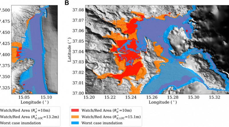
Testing Tsunami Inundation Maps for Evacuation Planning in Italy
Inundation maps are a fundamental tool for coastal risk management and in particular for designing evacuation maps and evacuation planning.
Read moreProbabilistic Tsunami Hazard Maps for the NEAM Region
Inundation maps are a fundamental tool for coastal risk management and in particular for designing evacuation maps and evacuation planning.
Read more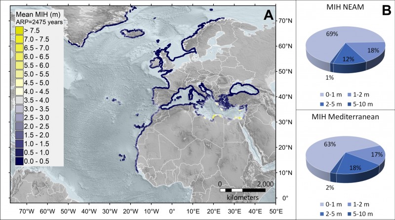
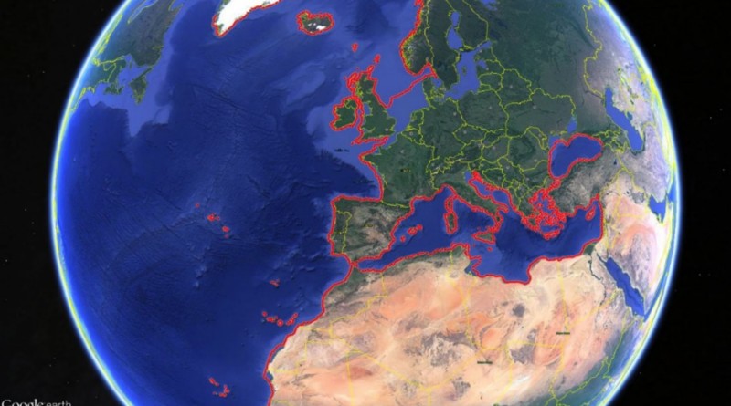
The NEAM Tsunami Hazard Model 2018 (NEAMTHM18) is a probabilistic hazard model for tsunamis generated by earthquakes. It covers the
Read moreAccelerating Global science In Tsunami HAzard and Risk analysis AGITHAR Working Group 1-3 Meeting Rome, January 14-17, 2020
Read more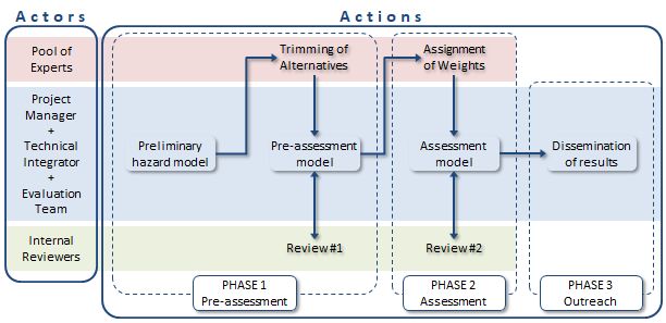
NEAMTHM18 Documentation: the making of the TSUMAPS-NEAM Tsunami Hazard Model 2018
Read more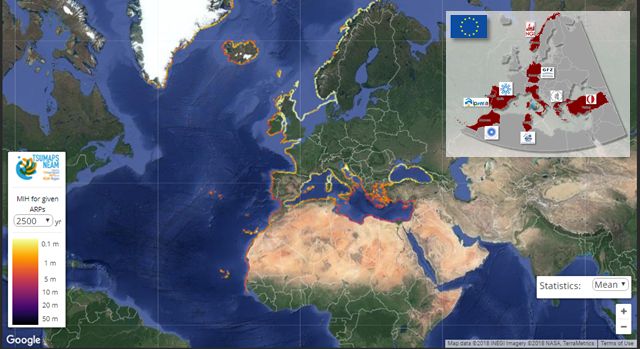
NEAM Tsunami Hazard Model 2018 (NEAMTHM18): online data of the Probabilistic Tsunami Hazard Model for the NEAM Region from the TSUMAPS-NEAM
Read more
Accelerating Global science In Tsunami HAzard and Risk analysis AGITHAR AGITHAR Scientific Kick-Off, Working Group and Management Committee Meeting Malta, October
Read more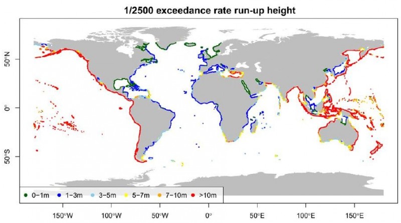
Large tsunamis occur infrequently but have the capacity to cause enormous numbers of casualties, damage to the built environment and critical
Read more
Tsunamis are rather infrequent natural events that can have a high impact. As such, they may have no historically-known precedents,
Read more
Location: Tunis, Tunisia Date: 11-12 September 2017 The TSUMAPS-NEAM Project Final Meeting aims to present the first homogeneous
Read more